


Year of Weather and NOAA satellites’ end-of-life
Call to action in the wake of dramatic cuts to NOAA services and the decommissioning of NOAA-15, NOAA-18 and NOAA-19
Dearest friends and weather co-conspirators,
We write with news of an ambitious new phase of open-weather’s collective weather sensing, recording and archiving efforts, at an unprecedented time in the history of environmental data collection and access.
In this newsletter we invite you to take part in the Year of Weather, open-weather’s current effort to create a historic record of weather over twelve months when the average global temperature has exceeded 1.5 degrees Celsius above pre-industrial levels.
The Year of Weather unfolds as NOAA publicises plans to decommission 16 environmental datasets, and to discontinue most data services from instruments on NOAA-15, -18 and -19 on 16 June 2025. In response, open-weather is working to support all Automatic Ground Station hosts and volunteer contributors to capture images from NOAA satellites before the 16 June deadline.

We are also launching the Year of Weather map, a living, collective map of planetary weather composed of satellite imagery contributions from DIY satellite ground station operators around the world.
Finally, we are announcing a call to participate in an ‘end-of-life’ nowcast on 15 June 2025, the day before most data services from NOAA-15, -18 and -19 will be terminated. This nowcast is the third of open-weather’s series of one-day earth-imaging events.
Year of Weather
All contributions to the Public Archive will be part of the Year of Weather. We invite you to take part!
The Year of Weather asserts and amplifies public access to environmental knowledge.
Over twelve months open-weather is activating a planetary-scale network of DIY Satellite Ground Stations to capture the last transmissions of three NOAA weather satellites as the planet exceeds 1.5 Celsius warming. In the Year of Weather, we ask: which weather knowledges should we be amplifying in our communities at this unprecedented moment in planetary history?
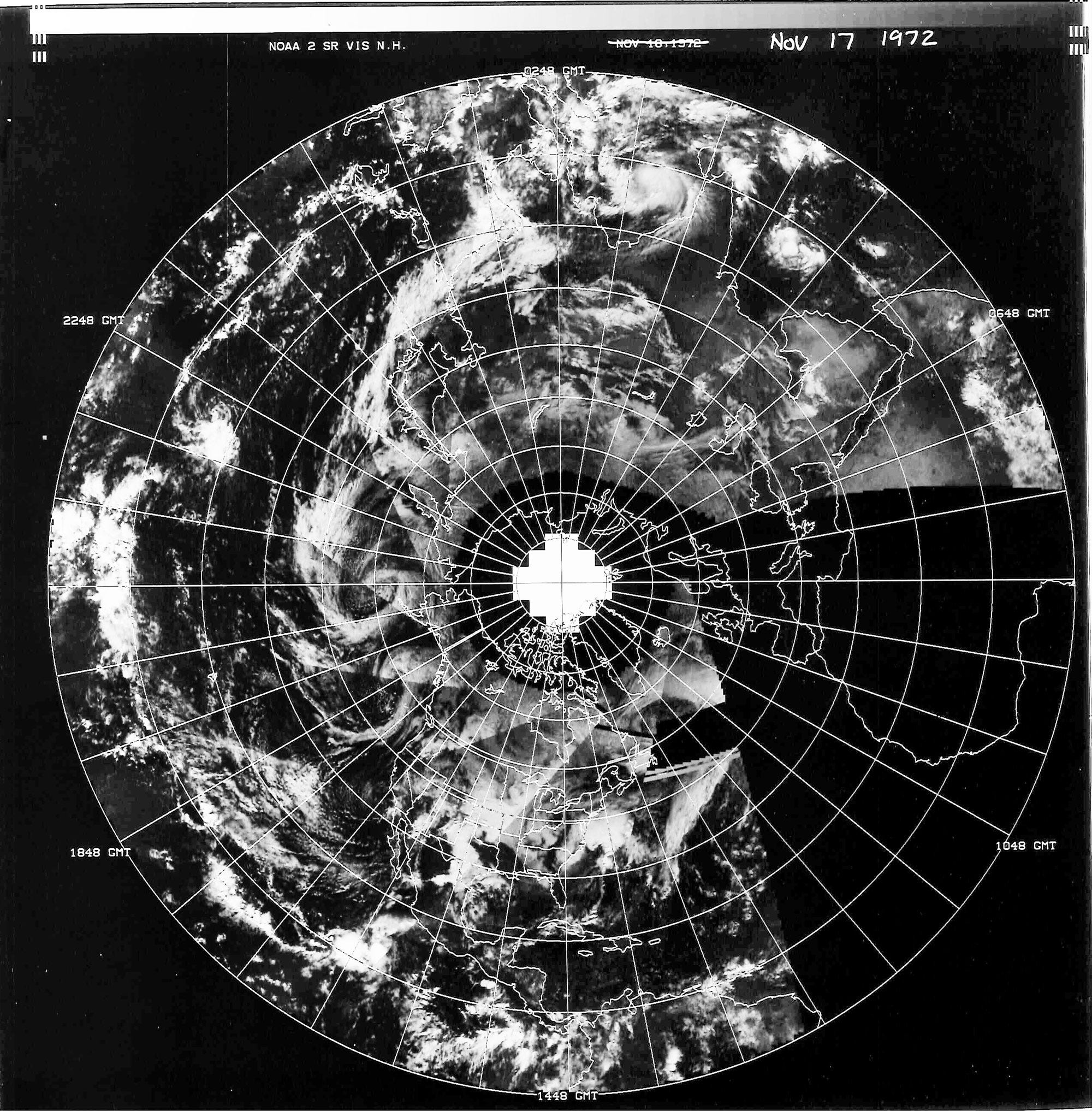
Public ownership and access to environmental knowledge is threatened by attempts to defund and dismantle government agencies, such as the US government’s National Oceanic and Atmospheric Administration (NOAA) that has provided satellite images to ground stations internationally since the 70s.
Today we launch the Year of Weather map, a living, collective map of planetary weather that will, we hope, record these historic changes and resist the privatisation of environmental data. All contributions to the Year of Weather will now appear, georeferenced, on an Equal Earth planetary projection. The map is the first of three Year of Weather ‘transmissions’; upcoming transmissions will feature satellite imagery and weather notes.
Huge thank you to Rectangle Studio (Lizzie Malcolm and Daniel Powers) for co-designing and developing the map based on open source code and knowledge built over years of collaboration.
End-of-life nowcast
The future of open-weather and NOAA’s analogue weather satellites is uncertain. While it is possible that the open-weather network and AGS hosts will continue to receive APT images after 16 June, and may be one of (or the only) networks distributing these images publicly after this deadline, the situation will be volatile.
To mark this major milestone in the lifespans and data services of NOAA-15, -18 and -19, we are organising an ‘end-of-life’ nowcast on 15 June 2025. This is the third in a series of one-day planetary imaging events by open-weather, see examples from 2020 and 2021.
How to participate
On Sunday 15 June (in your local timezone), capture a NOAA satellite image over your location. You are welcome to choose the pass from NOAA-15, -18 or -19 that works best for you.
Use our Contributor Form to upload your WAV file along with an optional (but highly appreciated!) weather note and documentation photographs to the Public Archive. All contributions on Sunday 15 June will automatically become part of the nowcast.
Automatic Ground Station hosts should liaise with Sasha and Sophie to attached weather notes and documentation photographs to their images on 15 June.
Open-weather will combine all satellite imagery, text and photograph contributions submitted to the Public Archive from around the world to produce a ‘nowcast’ to be released after 16 June via the Year of Weather map.
To ask questions please don’t hesitate to email: openweathercommunity@gmail.com
NOAA datasets will soon disappear
The Year of Weather unfolds as thousands of staff (up to 20% of NOAA’s workforce) have been fired or face threats of redundancy. In absence of public information about how these cuts relate to the imminent decommissioning of many environment and climate data services, we invoke the words of the Union of Concerned Scientists, that removing taxpayer-funded datasets “is tantamount to theft”.
Immediately relevant for open-weather and other communities relying on NOAA data, in late April NOAA quietly reported plans to decommission 16 datasets and services related to marine, climate, and earthquake science. Among the data products to be decommissioned is the data management and public distribution of NOAA’s last analogue weather satellites, NOAA-15, NOAA-18 and NOAA-19.
According to a ‘notice of changes’ published by NOAA, “The NOAA Polar Operational Environmental Satellites (POES) NOAA-15, -18, and -19 are nearing the end of their Extended Life phase. In preparation for the end of life of these satellites, NOAA is discontinuing data collection on June 16, 2025 at 1800 UTC for most instruments”.
Sources inside NOAA have added that APT and HRPT satellite imagery transmissions from NOAA-15, -18 and -19 will remain 'enabled' after 16 June, but they will not be "approved for operational use" (for example, key forecasting and safety operations). In addition, they will no longer be analysed or distributed via NOAA's Satellite Operations Facility.
On 2 May, President Trump presented a budget to Congress that would decrease spending in science agencies including NIH, NASA and NOAA by ⅓ to ½ in 2026. Specifically, the proposal would “break up” NOAA’s ocean research and coastal management programmes, and would cut by 74% the Oceanic and Atmospheric Research Centre, a leading source of global climate science and modeling that works in collaboration with the Geophysical Fluid Dynamics Laboratory at Princeton University, a lab that faces similar levels of defunding amounting to ‘total loss’.
While we are highlighting threats to environmental data collection and access based on cuts to US agencies, we recognise that similar processes are underway in other parts of the world, for example under Javier Milei’s administration in Argentina. We see the Year of Weather as intertwined with many other efforts to protect public resources, honour environmental and climate education, and recognise the deep, intergenerational histories that bind communities to place and landscape.
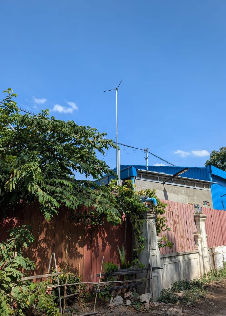
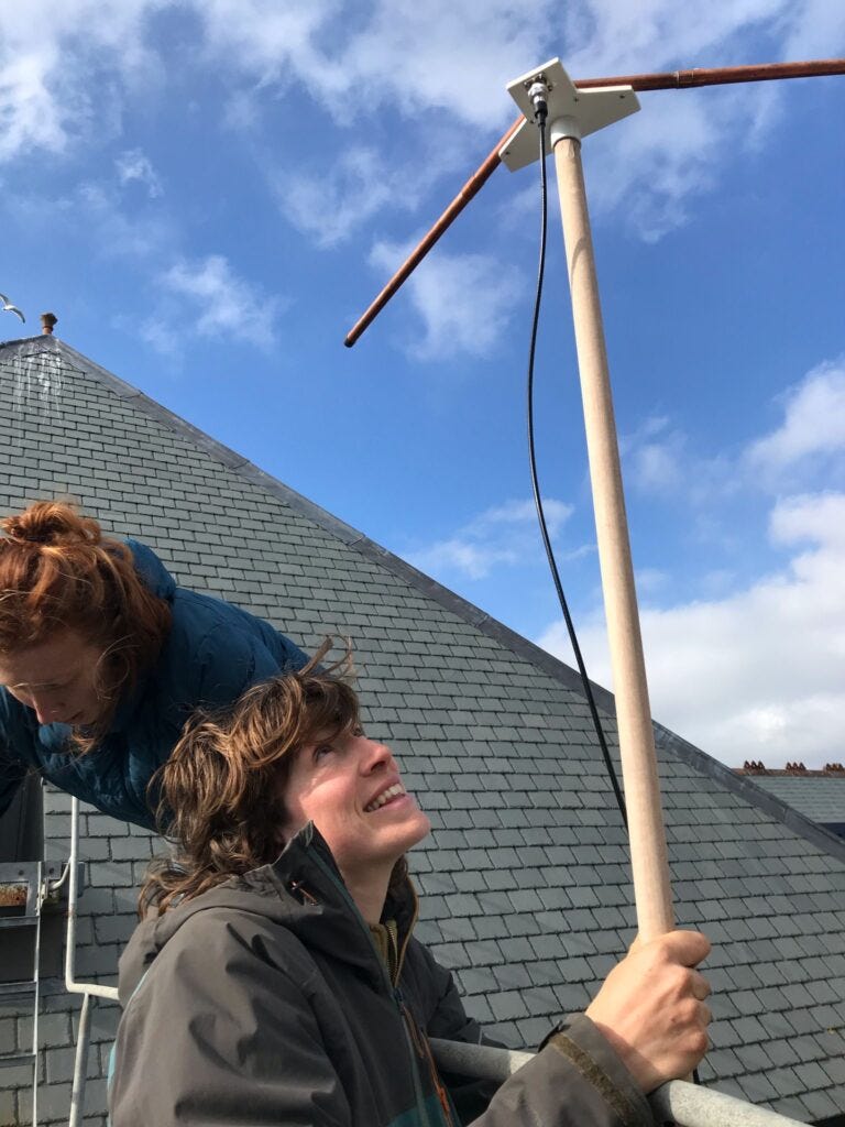
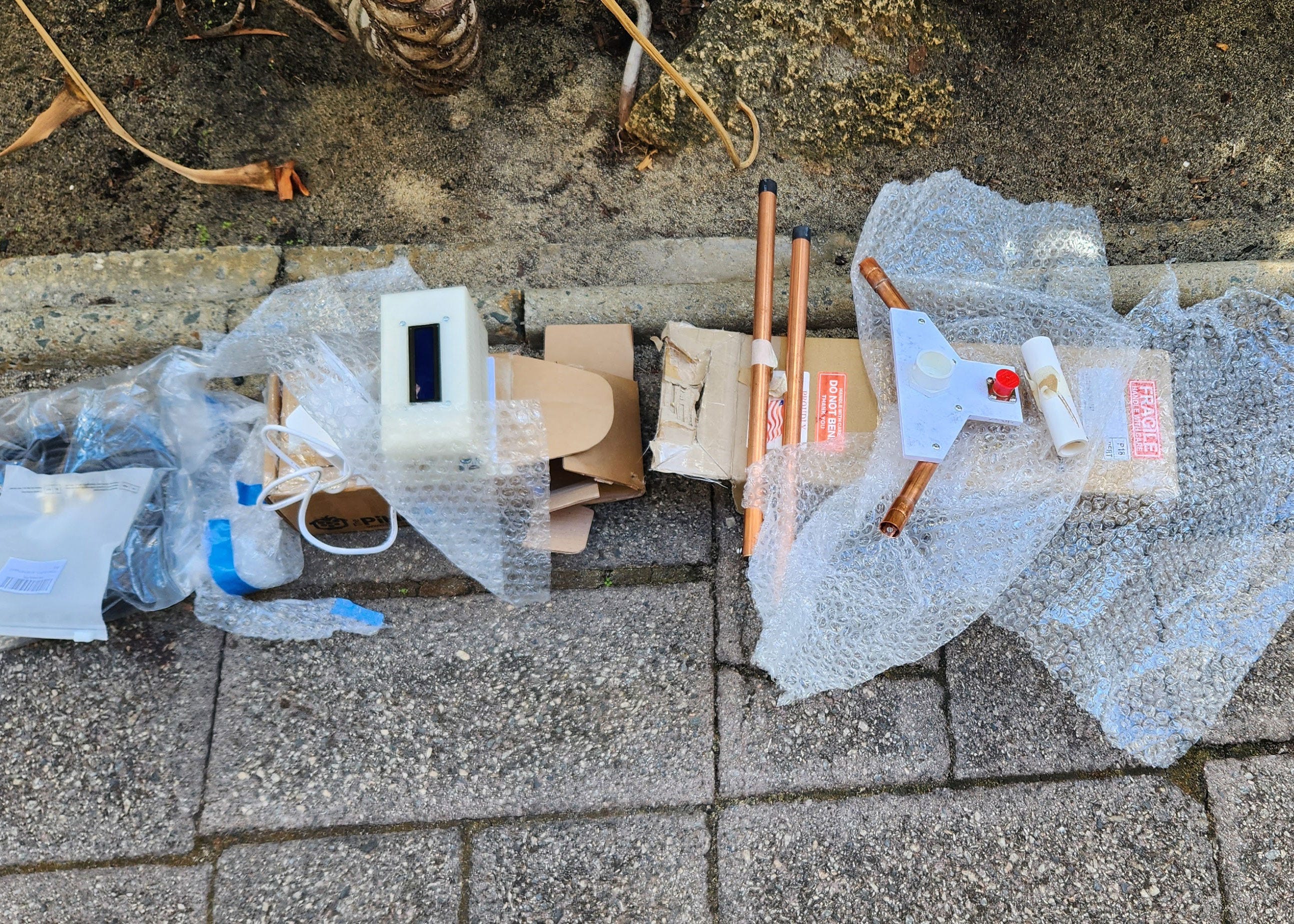
In concluding this newsletter, we are deeply grateful to Automatic Ground Station hosts in Arbroath; Cornwall; Pune; Nicosia; Phnom Penh; Valparaiso; Perth; Los Angeles; Seattle; New York; Gainesville; Cordoba and Barcelona for setting up stations, installing semi-permanent antennas and troubleshooting with us over the last few months. Special thanks to Ly Vouch Long (Oppressive Heat Project, Phnom Penh), Fernando Godoy (Tsonami Art Sonoro, Valparaiso), and Iterable Studio: Andres Belfanti and Federico Ragessi (Cordoba) who are the most recent AGS hosts to come online. We extend warm thanks to all volunteer contributors who have submitted to the Year of Weather. Finally, deepest thanks to Rectangle Studio and Grayson Earle for collaborating with us in these unusual times.
Warm wishes on 137 MHz,
Open-weather
For more information about upcoming workshops, talks, and how to take part, see the latest activities on our website.